Is the UK in Europe – Geography vs Politics Post-Brexit
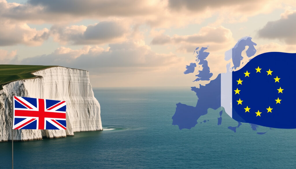
The question “is the UK in Europe” sparks surprisingly frequent debate, particularly since the 2016 Brexit referendum and the country’s formal exit from the European Union in 2020. The confusion often stems from mixing geographic location with political membership. This guide examines what the evidence shows about the United Kingdom’s position on the European continent, clarifies what changed after Brexit, and explains the composition of the UK itself.
Geographically, the United Kingdom sits off the northwestern coast of continental Europe, forming part of the island chain known as the British Isles. The country’s position on the European continental shelf places it squarely within Europe’s geographic boundaries, regardless of its post-2020 political status. Understanding this distinction requires separating geography from political organisation.
Is the UK in Europe?
The short answer is yes, the United Kingdom is geographically located in Europe. The UK occupies 94,354 square miles (244,376 km²), making it the largest country in the British Isles by both area and population, with over 69 million residents recorded in 2024. The nation sits on the European continental shelf as part of the Eurasian Plate, separated from mainland Europe by bodies of water including the North Sea, the English Channel, the Celtic Sea, the Irish Sea, and the Atlantic Ocean. The English Channel narrows to just 34 kilometres at the Strait of Dover at its closest point to continental Europe.
The United Kingdom lies entirely within the European continent’s geographic boundaries. This is a physical fact determined by the country’s location on the European continental shelf, not a matter of political definition or opinion.
Understanding the Three Key Terms
Clear terminology helps resolve confusion. The British Isles refers to the entire archipelago containing Great Britain, Ireland, and numerous smaller islands. Great Britain specifically denotes the largest island, covering 209,331 km² (the ninth-largest island worldwide), which hosts England, Scotland, and Wales. The United Kingdom officially encompasses Great Britain plus Northern Ireland, along with various offshore islands, giving a total area of 244,376 km².
Key Insights on UK Geography
- The UK sits on the European continental shelf, making it geographically part of Europe despite being an island nation
- The shortest distance to mainland Europe is just 34 km across the Strait of Dover
- The UK shares its only land border with the Republic of Ireland
- Britain (England, Scotland, and Wales) accounts for most of the UK’s land area
- The term “British Isles” encompasses the entire archipelago, including Ireland
- No authoritative geographic source disputes the UK’s European location
| Fact | Details |
|---|---|
| Continent | Europe |
| Total Area | 244,376 km² (94,354 sq mi) |
| Population (2024) | Over 69 million |
| Constituent Countries | 4 (England, Scotland, Wales, Northern Ireland) |
| EU Status | Former member, left January 2020 |
| Capital City | London |
| Closest Point to Europe | 34 km (Strait of Dover) |
| Land Border | Republic of Ireland only |
Is the UK Still Part of Europe After Brexit?
The answer depends entirely on whether the question concerns geography or political membership. Geographically, nothing changed—the UK remains in Europe. Politically, the United Kingdom ceased to be a member of the European Union on 31 January 2020, when the withdrawal agreement entered into force. This marked the end of forty-seven years of formal EU membership that began when the UK first joined the European Economic Community in 1973.
The distinction matters because geography operates independently of political organisations. The UK’s physical location on the European continental shelf, its proximity to mainland Europe at just 34 kilometres at the Strait of Dover, and its position within the British Isles archipelago all remain unchanged. These are immutable geographic facts that no political decision can alter.
Post-Brexit, the UK lost its membership in the European Union but retained its geographic position in Europe. The question “is the UK in Europe” must therefore specify whether it asks about location or political alignment.
UK Components: What Makes Up the United Kingdom?
The United Kingdom comprises four constituent countries: England, Scotland, Wales, and Northern Ireland. Each possesses distinct characteristics while sharing common institutions and governance under the UK Parliament in Westminster. The capital city, London, sits in England and serves as the seat of government.
The island of Great Britain—which encompasses England, Scotland, and Wales—represents approximately 73% of the UK’s total land area. Northern Ireland occupies the northeastern portion of the island of Ireland, sharing a 499-kilometre land border with the Republic of Ireland. This border became significant following Brexit, as it represents the UK-EU external boundary.
The British Isles: A Geographic Definition
The term “British Isles” designates the group of islands off the northwest coast of continental Europe, encompassing the island of Great Britain, the island of Ireland, and over six hundred smaller islands. This geographic grouping includes both the United Kingdom and the Republic of Ireland as distinct political entities. The term predates the current political situation and refers exclusively to geography, not political affiliation.
The archipelago sits on the European continental shelf, meaning the land beneath these islands is geographically connected to the European landmass. This geological relationship underpins the scientific consensus that the British Isles—and therefore the United Kingdom—form part of Europe geographically.
A Brief Timeline: UK and European Integration
Understanding the UK’s relationship with Europe requires examining key historical moments that shaped the current situation. The timeline below highlights significant events in the UK-EU relationship:
- 1973 — The United Kingdom joins the European Economic Community (EEC), the precursor to the European Union
- 1975 — A referendum on EEC membership results in 67% voting to remain
- 1993 — The Maastricht Treaty takes effect, formally establishing the European Union
- 2002 — The euro launches in participating EU member states; the UK retains the pound sterling
- 2016 — The Brexit referendum results in 52% voting to leave the EU
- 2020 — The UK formally leaves the EU on 31 January
- 2021 — The Brexit transition period ends on 31 December
Common Questions About UK Geography
Many readers ask specific questions about the UK’s geographic status. Here are clear answers to the most frequently encountered queries.
Is the UK geographically part of Europe?
Yes. The UK sits on the European continental shelf and lies within Europe’s geographic boundaries. This is a matter of physical geography confirmed by the UK’s position on the Eurasian Plate. No political arrangement changes this fundamental fact.
Is the UK politically part of Europe?
The UK is not a member of the European Union following Brexit, but it remains part of Europe geographically. The UK participates in various European organisations for cooperation in areas such as defence, trade, and security, though these are separate from EU membership.
Does being an island mean the UK is not in Europe?
No. Many countries in Europe are islands, including Ireland, Iceland, Cyprus, and Malta. Geographic location on a continent or continental shelf determines continental membership, not whether a country occupies an island. The UK qualifies as a European country through its position on the European continental shelf.
What changed after Brexit?
After Brexit, the UK lost its membership in the EU and ceased participation in EU institutions, the single market, and the customs union. Trade agreements, immigration policies, and regulatory frameworks became independent of EU structures. The geographic position remained unchanged.
Summary: The Verdict on UK Geography
The evidence consistently demonstrates that the United Kingdom is geographically located in Europe. The UK occupies a position on the European continental shelf, lies within the British Isles archipelago, and sits just 34 kilometres from mainland Europe at the Strait of Dover. These geographic facts remain unchanged regardless of political developments.
Post-Brexit, the only alteration concerned the UK’s membership in the European Union. The country retained its geographic position while losing its political affiliation with the supranational organisation. This distinction between geography and political membership explains why the answer to “is the UK in Europe” depends entirely on how the question is interpreted.
For practical purposes, the UK remains a European country geographically, participates in European affairs through bilateral and multilateral channels, and maintains its position as a significant European nation in trade, culture, and international relations. The distinction between EU membership and European identity matters enormously when discussing the UK’s place in the world.
More related posts
 Bert Kreischer – Biography, Age, Net Worth, Machine Story
 Rhaegar Targaryen – Death, Family, and Prophecy Explained
 Chris Stussy – Biography Tour 2025 and BBC Residency
 Al-Ittihad Club Games – Fixtures, Results & Tickets Guide
 Luton Long Stay Car Park – Prices, Shuttle & Directions
 How Many Weeks in 6 Months – Calendar vs Lunar Contexts
 How to Cut a Mango – Easiest Step-by-Step Methods
 Silver Rings for Women – Complete Buying Guide and Care Tips
